The Plan for Growing Sydney

PlanForGrowingSydney
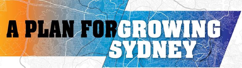
The State Government’s Plan for Growing Sydney was released in December 2014. In the plan Chatswood is declared as being a Strategic Centre, The plan is to locate employment and jobs within the strategic centres. Another facet of the plan is to reduce commute times to work. This can be achieved by placing increased residential density at strategic centres such as Chatswood.
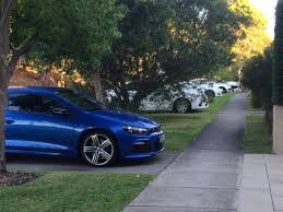
Another key tenet of the plan is to ‘accelerate housing supply’.This will be targeted for strategic centres, placing Chatswood under increasing stress (both in terms if infrastructure as well as social pressures).

The Government is working to achieve its target of an additional 664,000 new dwellings across Sydney by 2031. They posit that local councils need to understand and respond to the housing
market (or else?) A strategy is to ACCELERATE NEW HOUSING IN DESIGNATED INFILL AREAS (ESTABLISHED URBAN AREAS) (such as Chatswood?)

The specific objective on the plan for Chatswood is:

Work with council to provide capacity for additional mixed-use development in Chatswood including offices,

For the past ten years, even with similar objectives for jobs growth and employment in Chatswood, the State Government has overturned Council plans in favour of allowing more high rise development. Will this new plan really change anything?

Advertisement

New player on planning front

SydneyCommissionThe State Government is advertising for staff for its recently announced Greater Sydney (Planning) Commission. The Commission will oversee the implementation of ‘A Plan for Growing Sydney‘. It will advise the Government on planning priorities and infrastructure.

A key platform of the Plan for Growing Sydney is providing greater housing choice. This means change for our residential suburbs where we will see increased numbers of medium and high density residential towers. In the past year new strata units have outpaced traditional residential house by 9:1 (nine units for every house built).

There will be six planning districts across Sydney. The Commissioners of the planning districts are also members of the Sydney Planning Panel which will have plan making and development assessment functions. This is another example of the State Government devolving decision making away from local communities. You can anticipate that the new planning model will also reduce the amount of public consultation over new planning proposals.

815 Pacific Highway, Chatswood

HighRiseDemolitionA Planning Proposal has been lodged for this site. The site covers property between McIntosh Street and Help Street. There is a thirteen storey building on the corner of Help St and the Pacific Highway (The building with the external lift).

The planning proposal advises the objective is to provide shop-top housing on the site in
addition to the existing permissible uses on the site. This will require demolition of the existing building on the site.

To my knowledge, this is the first proposal within Willoughby City to propose the demolition of a high rise building. The building dates back to c.1960s, so over 50 years old. However, it looks to be in good condition.

The Council Officers did not support the application for the following reasons in summary:
1. Excessive increase in height and floor space on an edge site in Chatswood CBD.
2. Shadowing impacts on the residential areas to the west and on the passive open
space plaza areas within Chatswood CBD.
3. The application does not adequately demonstrate significant growth in business
services and jobs.
4. The application does not adequately deal with the traffic impacts.

5. The application is not sufficiently consistent with A Plan for Growing Sydney and
other strategic planning documents.
6. The application has not addressed the precedent of the proposal and its implications
for the future of Chatswood as a compact and dynamic CBD.
7. The application has not adequately demonstrated any net community benefit for the
proposal.

COUNCIL resolved not to support the proposal.

Currey Park Update

Hi Dominic,

Thanks for your reply.

Firstly let me say that I understand it is never easy for Council to balance Community needs with Developers (commercial) requirements.

It can be a thankless task trying to keep all parties happy.

However (and there is usually an however attached to such statements) in the case of Currey Park it is abundantly clear that there has been, and still remains, a severe imbalance in favour of the Developer (Westfield) and at the expense of Community land and public space.

This imbalance is one of both fact and of perception.

The reclassification of land from Community to Operational was no small step.

Council may claim that procedure was followed as far as public notice was concerned, but the fact remains that it was lost on most members of the public at the time due to limited exposure and difficulty in understanding any potential future impacts and repercussions.

Even now, on reading the documents you provided, it is far from easy deciphering what is actually proposed.

There was certainly no mention or explanation of the negative impact and repercussions the reclassification of this parcel of land would have on significant public parkland and amenity (Currey Park).

As far as I can determine the felling of irreplaceable 40ft+ high mature, healthy Gums that provided a home for birds and native wildlife – and the canopy of which provided shade, screening and visual amenity – was not even mentioned at the time of issue of these documents.

Council’s Arborist subsequently classified these particular trees as of ‘high retention value.’

It was not only the axing of the trees that has proven damaging. The culling of smaller trees and disturbance to associated greenery, gardens and landscaping has further impacted adversely on native birds and animals, such as the brush turkey who had made the park his home and who has not been sighted since the felling of the trees and the erection of fencing.

Nearby residents only became aware of some of the implications of this part of the development as a result of the belated letterbox drop from Scentre Group on August 12 (dated July 29) and an online petition.

Regrettably both Council and Westfield have failed to consider the more recent protestations of concerned residents and the Community at large – including the parents of children at the Devonshire Street day care centre.

Representations to Willoughby Council and Scentre Group through letters, emails, the petition with many individual comments (presented to Council at the most recent meeting), together with continuing coverage through traditional and social  media appear to have fallen on deaf ears.

As have approaches from MP’s, progress associations and community leaders.

This lack of concern, community consultation and response from both Council and Westfield provides the strongest possible indication that both parties are determined to push this part of the Development through, no matter the cost or consequences.

To the present, and we now have the untenable situation of a large section of Currey Park off limits to the public – divided down the middle by tens of metres of fencing , gates, padlocks, chains and Keep Out signs.

Until your response was received on Wednesday September 2, there was no indication or notification that the Park is to become a construction / works zone for Westfield for a protracted period.

In fact, the vast majority of people remain unaware of this.

The response that “Westfield have applied for and been granted a permit to conduct (the) works from July 1 2015 to December 31 2015(because) there was no other way they could actually do the works …. (due to) current slab heights” is astounding in its depiction of Council’s willingness to grant the Developer whatever they request.

Westfield have a carpark with, at present, 2,880 spaces over a large area of land.

It is up to Westfield, with their vast resources, to solve this problem for their own development rather than using Community land (resulting in a substantial loss of public amenity) to solve it for them.

It appears that they do not want to impact on any of their parking space in the lead up to Christmas trading.

How they were ever granted “Temporary Access Over Community Land” in the first place beggars belief, as they fail to meet most of the criteria before they even start.

There is already damage to existing trees (outside the rezoned operational land), vehicle movements across the land (which will only multiply), and severe detrimental impact on the visual amenity of the land through the aforementioned fencing, gates, locks, chains, signs, etc).

In fact the affected area looks like a destruction zone.

Of further concern is the area incorporating the pathway between Devonshire Street and Currey Park.

This area has also had fences and signs erected and is currently off limits.

As far as I am aware, this area is Community Land well away from the proposed work zone or development area.

Why is this area fenced off?

And is there to be any further felling of mature trees in this or any other area of Community Land?

On behalf of many concerned residents and members of the Community, I respectfully ask that Council revisit this area of the Development and reconsider the impacts on the park, neighbourhood, community and public, by putting a stop to the protracted use of such a significant area of community land in Currey Park  for private development.

It is not too late and there is too much Community concern – with the impact and loss of amenity too great – for this to be ignored any longer.

Awaiting your response.

Sincerely

Mandarin Centre Redevelopment

Mandarin

The Mandarin Centre Redevelopment Planning Proposal is long and complex. You can read the full report: 9.5 Planning Proposal 2013-4 – 65 Albert Avenue, Chatswood (Mandarin Centre) – 1 of 2 (1)

Below is the part of the Conclusion from the Report.

Conclusion
The Planning Proposal for the mixed use development of the land Lots 1, 2 and 3 DP1035379 and Lots 41 and 42 DP 1150370 at 65 Albert Avenue, Chatswood, and the Concept design is generally supported subject to a number of areas of concern being adequately addressed.

The additional use of shop top housing on the site is consistent with the priority for Chatswood, identified as a strategic centre in ‗A Plan for Growing Sydney‘, and is supported in this case. In addition the footprint of the two towers above the Podium and the height of the Eastern and Western Towers are generally supported subject to floor space concerns and compliance with SEPP 65. The lower Western Tower and elliptical shaped Eastern Tower are considered acceptable solutions in maximising views and minimising adverse privacy impacts on the neighbouring properties.

The proposed floor space ratio is an issue because there is concern that the floor space proposed is unable to be located within the building foot prints and envelopes shown in the Concept design. Furthermore it is noted that the Concept does not comply with the building separation requirements of SEPP 65 and the accompanying Apartment Design Code.

It is recommended that the Planning Proposal have a floor space ratio of 8.65:1 excluding affordable housing with shop top housing not exceeding 4.42:1, and a commercial component not being less than 4.23:1. The reduction in the residential component from 6:1 to 4.42:1 results in the loss of approximately 50 residential units. The commercial component of 4.23:1 is slightly lower than the 4.5:1 as discussed in 5 May 2014 Council report, however this is considered acceptable as discussed in the report.

Mowbray Precinct Traffic Review

READ THE FULL REPORT: 9.1 Mowbray Road West Traffic Study (1)

Mowbray 7 SepOFFICER’S RECOMMENDATION That Council:

1. Endorses the Mowbray Road West Traffic Study Addendum Report, with the exception of items 4a and 5.

2. Implements the high and medium priority recommendations listed in this report, subject to Traffic Committee and Council approval of the individual recommendations and appropriate community notification, with the exception of item 6, which will require a further report to the Traffic Committee, those high and medium priority recommendations being;

 Item 1 Mowbray Rd/Pacific Hwy – Lobby RMS to investigate improvements to intersection efficiency (High)

 Item 13 Mowbray Rd West/Hatfield St/Kullah St – Introduce traffic signals (High)

 Item 3 Mowbray Rd West/Centennial Ave – Introduce dedicated right turn phase on Mowbray Rd West (High)

 Item 2 Mowbray Rd West/Beaconsfield Ave – Re-introduce right turn and through movements at traffic signals (High)

 Item 4b Coolaroo Rd/Greenlands Rd – Upgrade lighting, clear vegetation and extend BB lines (Medium)

 Item 7 Mowbray Rd West at Dalrymple Ave, Felton Ave & Mooney St – Install ‗No Stopping‘ restrictions on north side of Mowbray Rd West (Medium)Item 14 Mowbray Rd West/Willandra St – support option 2 from SMEC proposals to improve operation and safety of intersection (Medium)

 Item 4c Coolaroo Rd/Dalrymple Ave – upgrade signage and linemarking, extend BB lines (Medium)

 Item 8 Mowbray Rd West, westbound departing Pacific Hwy – Form 1 Lane signage (Medium)

 Item 9 Mowbray Rd West/Dalrymple Ave – Install ‗No Stopping‘ on south side of Mowbray Rd West (Medium)

3. Advises Lane Cove Council that Willoughby City Council gives qualified support to the recommendations made in the SMEC Study along the lines of the commentary in this report.

4. Provides Lane Cove Council with a copy of the PeopleTrans study and advised of the additional recommendations made in that report regarding Felton Avenue, Dalrymple Avenue and Pacific Highway and their support requested for the implementation of those measures.