 Recently you should have received a coloured 4 page brochure from Council titled ‘Community Assets’ containing ‘important information about a proposed infrastructure levy” An infrastructure levy is another name for a proposed rate increase.
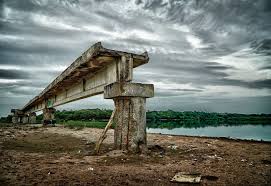
It is common knowledge that over the past decades Councils have allowed their physical assets (buildings, roads, parks, footpaths, playgrounds and the like) to deteriorate whilst they increased the range of social services (often competing for clients against the State and Federal Government (as well as private enterprise). This situation has been exacerbated by the State Government’s Rate Pegging which doubly hit Willoughby because that had traditionally low rate.
Now the rooster has come home to roost. Council is trying to rapidly address its deteriorating infrastructure. (This issue is also a driving force in the State Government’s encouragement for Council’s to amalgamate).
Just prior to the recent Mayoral election, the Council Officers had prepared a report on this issue. However, the Councillors deferred consideration of the report. In doing so, they directed the General Manager to investigate where interna; saving could be made.
In Table 2 (p.3) Increased efficiencies and other income sources there is notation of a $500,000 saving in year 1 with sequent year savings on $1,000,000. However, there are not any details of how these savings are to be achieved. It looks like someone has picked a number out of the air and dumped it in the report. Later on, when finances become more dire and planned savings have not been achieved, we will likely be advised that this was a ‘planning’ figure only. We need to see the details of these proposed cost savings. (average $1M pa)
It is planned to generate more revenue from car parks. That will probably mean more and higher costs to park in Chatswood. (Average $150,000 p.a)
Advertising ‘bollards’ are slated to raise millions over the coming years (Average $400,000).That sounds like a hell of a lot of advertising bollards.
It is claimed that bus shelters will bring in an average of $800,000 p.a. However, this requires more explanation as Willoughby has always received revenue from bus shelter advertising. So is this truly new revenue?
Finally, the expectation is for another $200,000 per annum from Parking fees in the CBD. An interesting thing about this specific proposal is that the figure is not even indexed – just a straight $200,000per annum.
In summary, what we have been presented in Table 2 is the classical mushroom room farming approach: stick them in a dark space and feed them lots of ….”
Levy Options
Council has prepared four different levy scenarios:
Scenario 1 is the ‘crash & burn’ one. Standard rate pegging but no money to fix decaying infrastructure.
Scenario 2 leaves a 20% shortfall in required funding.
Scenario 3 meets the renewal gap over the next 7 years and logically should be the one to consider if we can afford it.
Scenario 4 leaves a 5% required funding shortfall.
What would Scenario 3 entail?
Currently, the average residential rates & levies total $1,417.50. Under Scenario 3, for next year, the average would be $1,480.51 ($63.01 increase). Both Scenarios 2 & 4 would incure an average increase of $67.45 next year.
Community feedback is open to 5pm on 21st October 2014
Planned rate increases
Recently you should have received a coloured 4 page brochure from Council titled ‘Community Assets’ containing ‘important information about a proposed infrastructure levy” An infrastructure levy is another name for a proposed rate increase.
It is common knowledge that over the past decades Councils have allowed their physical assets (buildings, roads, parks, footpaths, playgrounds and the like) to deteriorate whilst they increased the range of social services (often competing for clients against the State and Federal Government (as well as private enterprise). This situation has been exacerbated by the State Government’s Rate Pegging which doubly hit Willoughby because that had traditionally low rate.
Now the rooster has come home to roost. Council is trying to rapidly address its deteriorating infrastructure. (This issue is also a driving force in the State Government’s encouragement for Council’s to amalgamate).
Just prior to the recent Mayoral election, the Council Officers had prepared a report on this issue. However, the Councillors deferred consideration of the report. In doing so, they directed the General Manager to investigate where interna; saving could be made.
In Table 2 (p.3) Increased efficiencies and other income sources there is notation of a $500,000 saving in year 1 with sequent year savings on $1,000,000. However, there are not any details of how these savings are to be achieved. It looks like someone has picked a number out of the air and dumped it in the report. Later on, when finances become more dire and planned savings have not been achieved, we will likely be advised that this was a ‘planning’ figure only. We need to see the details of these proposed cost savings. (average $1M pa)
It is planned to generate more revenue from car parks. That will probably mean more and higher costs to park in Chatswood. (Average $150,000 p.a)
Advertising ‘bollards’ are slated to raise millions over the coming years (Average $400,000).That sounds like a hell of a lot of advertising bollards.
It is claimed that bus shelters will bring in an average of $800,000 p.a. However, this requires more explanation as Willoughby has always received revenue from bus shelter advertising. So is this truly new revenue?
Finally, the expectation is for another $200,000 per annum from Parking fees in the CBD. An interesting thing about this specific proposal is that the figure is not even indexed – just a straight $200,000per annum.
In summary, what we have been presented in Table 2 is the classical mushroom room farming approach: stick them in a dark space and feed them lots of ….”
Levy Options
Council has prepared four different levy scenarios:
Scenario 1 is the ‘crash & burn’ one. Standard rate pegging but no money to fix decaying infrastructure.
Scenario 2 leaves a 20% shortfall in required funding.
Scenario 3 meets the renewal gap over the next 7 years and logically should be the one to consider if we can afford it.
Scenario 4 leaves a 5% required funding shortfall.
What would Scenario 3 entail?
Currently, the average residential rates & levies total $1,417.50. Under Scenario 3, for next year, the average would be $1,480.51 ($63.01 increase). Both Scenarios 2 & 4 would incure an average increase of $67.45 next year.
Community feedback is open to 5pm on 21st October 2014
The City of Willoughby and Chatswood is a great place to live, however, like those before us, we may need to make some sacrifices to maintain our quality of life.
 Urbis Consultants, acting for the Church of Scientology Australia (CSA), have issued their first newsletter. Probably the most concerning planning aspect of the proposal is the intention of having up to 460 people on site daily between 8:30 AM and 9:30 PM.